Developer Tools●●●Banger
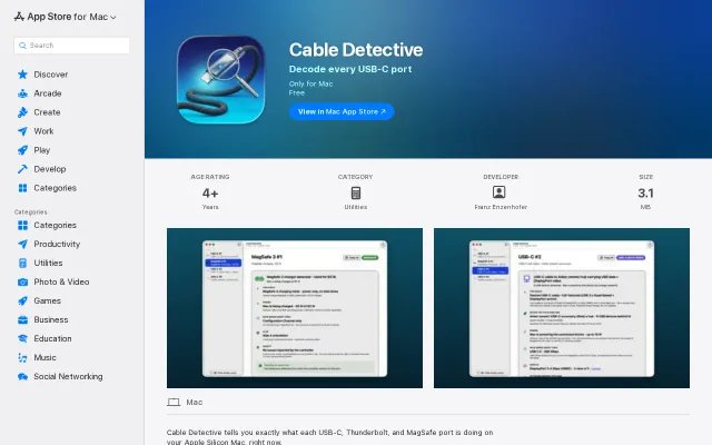
Cable Detective
Reveals actual USB-PD contracts and e-marker data that macOS hides from users.
Solve My ProblemDark Horse
franze
202mo ago
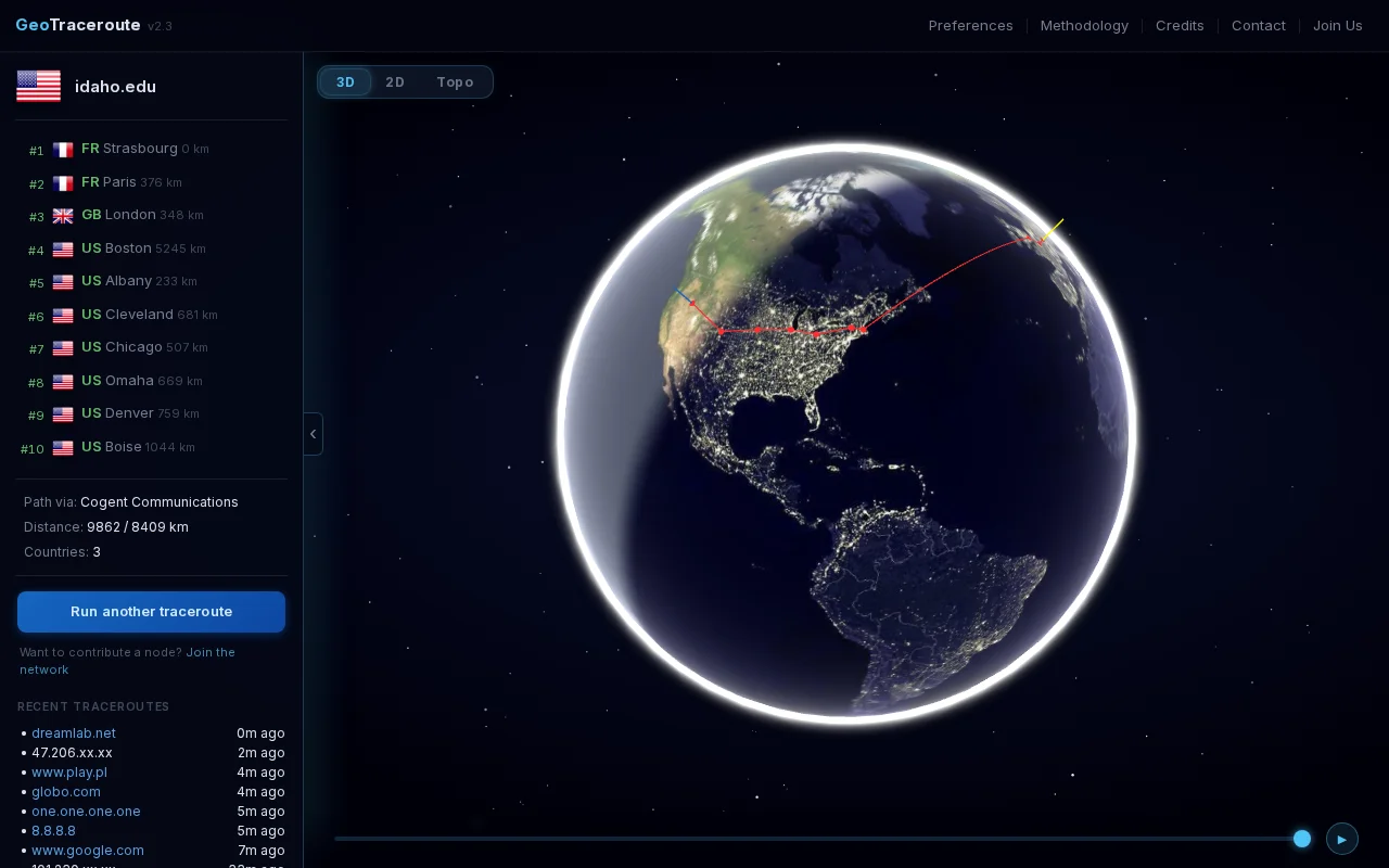
Infers invisible submarine cable paths using A* pathfinding between ocean-crossing hops.
Network engineers, sysadmins, and internet infrastructure enthusiasts
RIPE Atlas · PingPlotter · VisualRoute
A few things that might interest HN:
- 320 community-contributed nodes across 50 countries, all volunteer-run - Three views: 3D globe with day/night rendering, 2D map, and a topological mode that infers submarine cable routing - The submarine cable inference is the part I find most interesting. Since cable routers don't respond to ICMP, the underwater segments are invisible to standard traceroute. The tool detects ocean crossings by geolocation delta between consecutive hops, then infers the likely cable using a geo graph of landing points with A* pathfinding. I have no way to validate this — if anyone has ideas, I'd love to discuss.
Coverage is good in EU and US but thin in Asia, Africa and South America. If you want to contribute a node: https://geotraceroute.com/join
Salim
Reveals actual USB-PD contracts and e-marker data that macOS hides from users.
Standard lifestyle advice article, not a software project for Show HN.
Nostalgic cable TV interface for browsing Italian YouTube channels.
Finally reveals what your USB-C ports are actually doing beyond marketing specs.
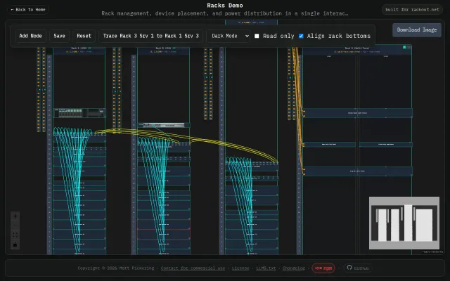
Interactive cable tracing between racks shows power paths visually in React.
Cable proximity alerts on shadow fleet vessels when MarineTraffic only shows positions.